
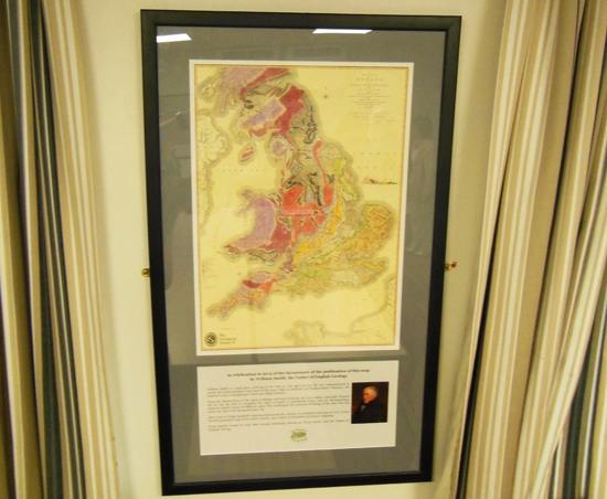
In 2015, Timsbury celebrated the 200th anniversary of William Smith’s map that changed the world. William Smith is a local hero, arriving in the area in 1791 aged just 22. He was commissioned to survey the Somersetshire Coal Canal in the Cam Valley in Radford and Paulton below Timsbury. He lived for a time at Rugbourne Farm, near High Littleton. After years of single-handedly studying land across the country, he published this map in 1815. It was the first geological map of an entire country, and the basis of all modern geological mapping. From his observations of the canal workings and from studying the local mines, especially Mearns Pit, he was the first to recognise the value of fossils in correlating strata, and for distinguishing between similar layers of different ages. This challenged the common thinking of the time that the earth was only a few thousand years old. From humble origins he was only later nationally famous as Strata Smith. His story and his map were popularised in a book in 2001 entitled The Map that Changed the World by Simon Winchester. William Smith is world famous for publishing the first geological map in the world of England and Wales in 1815 and for helping our leap in understanding of how the land’s strata and fossils illuminate the history of the earth.


The route of the Somersetshire Coal Canal

The Canal had two branches, with connecting tramways to the numerous small coalpits in the neighbourhood. The main (northern) branch, ten miles long, ran along the Cam valley from the terminal basins at Paulton and Timsbury to the junction at Dundas in Monkton Combe. At Midford it was joined by the southern branch from Radstock along the Wellow valley. By 1801 most of the waterways were complete, although lack of water on the southern branch led to its abandonment in 1814 in favour of a tramway along the towpath. During its operating life over the next 100 years, the Canal was one of the most profitable in the country. By the 1820s the Canal was carrying over 100,000 tons of coal per year, mainly to the inland markets of Wiltshire and Berkshire. Although competition from steam locomotion was resisted for a while, the Canal could not adapt to the changing patterns of coal extraction in the coalfield, and in 1871 the Radstock arm was sold to the Somerset & Dorset Railway Company who built the Bath to Evercreech line over much of its course. Main line trade was also reduced in 1881 when the Bristol & North Somerset Somerset Railway was extended from Hallatrow to Camerton. In 1894 the Canal was unsuccessfully put up for sale and in 1898 was closed to traffic. It was eventually bought by the GWR in 1904 to build the Camerton to Limpley Stoke branch line (the ‘Titfield Thunderbolt’ line), completed by 1910. Read more about the history of the Canal here.
The Canal Today
All these railways themselves were closed by the 1970s when coal mining in Somerset ceased. Although much of the Canal has also blended back into the landscape, remains of most of its structures have survived, including aqueducts, bridges, tunnels and basins, together with the Combe Hay lock flight. At its junction with the Kennet and Avon Canal at Dundas, the first 500 yards of the Canal has been restored and is used as moorings at Brassknocker Basin. Much of the Canal you can walk along where it is accessible by public footpaths.
Canal Restoration

In 2015 the Somersetshire Coal Canal Society with landowners started restoring parts of the Coal Canal in the Cam Valley, beginning with the canal terminus at Paulton and Timsbury Basins. Progress is being made on the restoration of the abutment walls at Terminus Bridge and repairs to the bridge abutments and sluice gate.Two retired stonemasons are helping to rebuild the walls and the nearby sluice gate. The current restoration work at Paulton in 2023 has been funded by a generous grant from the Paulton Parish Council, using Community Infrastructure Levy funding.
Information Boards

Details of local walking books with routes that include sections of the Somersetshire Coal Canal can be seen here.