• Skip to main content

Timsbury community website

Facilities, groups, parish council and business information for the village of Timsbury, near Bath

  • Home
  • Parish Council
    • About the Parish Council
    • Members & committees
    • Meetings
    • Policies & Procedures
    • Elections and Co-options
    • Finances
    • Communications
    • Activities & Responsibilities
    • Planning
  • Activities
    • Arts, drama & music
    • Children
    • Youth
    • Social
    • Events
    • Fitness, Health & Wellbeing
    • Sports & Games
    • Gardens, Food & Environment
      • Green Action Group
    • Walks
    • Churches
  • Hub Library
  • Facilities
    • Halls & rooms
    • Accommodation
    • Food & drink
    • Shops & Others
    • Schools & Childcare
    • Defibrillator
  • Live issues
    • Planning & Local Plan news
    • Major Planning Sites
    • Climate & Green Action
  • News
  • Village
    • About Timsbury
    • Gallery
    • Village plan 2009
  • Contact
  • Timsbury Letter
  • History
  • Search Timsbury website

Walks in and around Timsbury

Last updated: 14/04/2026

RETURN TO HISTORY MAIN MENU

Timsbury and the surrounding countryside is a wonderful area full of contrast and there is no better way to absorb its beauty, variety and history than by walking the many footpaths of the Public Rights of Way (PROW) network.

  • An aerial view of Timsbury showing its position on the White Lias Plateau.
  • Below Timsbury is the Cam Brook Valley.
  • St Mary’s Church. In 1614 the village consisted of about 50 dwellings, most of them located around the church and Church Lane.
  • There are several Grade II Listed buildings in the village, including Parish’s House.
  • The Seven Stars is the local village pub.
  • There are many footpaths leading from the village into the surrounding countryside.
  • The Ha-Ha is a well known local path. The path used to pass Timsbury House; an Elizabethan building that was the home of the Samborne family for many generations. The house was demolished in 1961.
  • There are a number of information boards in the parish. This one is at the end of the Ha-Ha.
  • From the Ha-Ha, there are good views towards other local villages.
  • Farmborough Common (sometimes known as One Tree Hill or Two Tree Hill) is an iconic local feature
  • There are quiet lanes. This is Parkway Lane, which is an ancient routeway.
  • Farmborough Common is a distinctive feature from the surrounding countryside.
  • The walk to Priston is very popular.
  • The area around Timsbury is a mixture rolling countryside, fields and trees.
  • The Sleight is a prominant ridge with wide ranging views south and north.
  • Timsbury is part of the former North Somerset Coalfield and coal mining played an important part in the history of the village. This walk from Timsbury passes the batch of Lower Conygre Coal Pit.
  • Mill Lane is an ancient routeway that passed through Timsbury.
  • A view from Tyning with the grassy spoil heap of a former coal mine ahead.
  • There are many keen walkers who enjoy the open countryside surrounding the village.
  • Here walkers are looking at Paulton Basin. This is the terminus of the former Somersetshire Coal Canal which ran along the Cam Brook Valley.
  • Coal was transported on tramways from the surrounding mines to the canal and then shipped by barges to Bath and Bristol.
  • The Basin is also a nature reserve.
  • There is also a disused railway line which is now a permissive path.

Walking is good exercise for body and mind and a chance to meet new people. Great pleasure can be had from walking in and around Timsbury.

There are plenty of routes to choose from, whether a gentle stroll around the village or longer walks further afield. The Definitive Map below shows all the PROWS – footpaths on which the public have a legally protected right to pass and re-pass, or roam. PROWs are paths on which the public have a legally protected right to pass and re-pass, or roam. They are managed by BathNES Council. Their website has information about PROWs, walk leaflets, online mapping and reporting problems. There are many PROWs around the village. The maintenance of PROWs is usually divided between the Council, landowners and occupiers. The Council usually assists landowners to improve stiles and gates particularly if it results in improvements to the path furniture e.g. replacement of a stile with a gate. Many of the stiles and footpath signs around Timsbury have been replaced with kissing gates which BathNES Council funds and local Ramblers Association groups voluntarily carry out the work.

The Ordnance Survey Explorer Map 142 (Shepton Mallet and Mendip Hills East) and 155 (Bristol and Bath) also show the local footpaths. However, there is a series of good local books, the Coal Canal Way Walks Booklet and online material providing suggested walks.

Walking Books

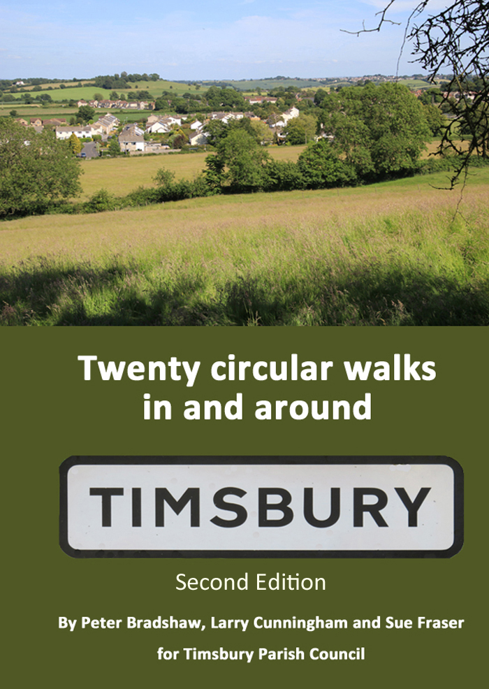
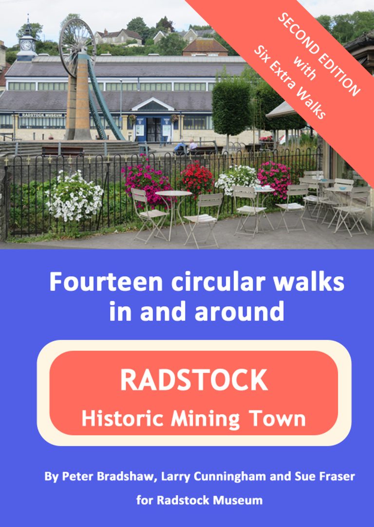
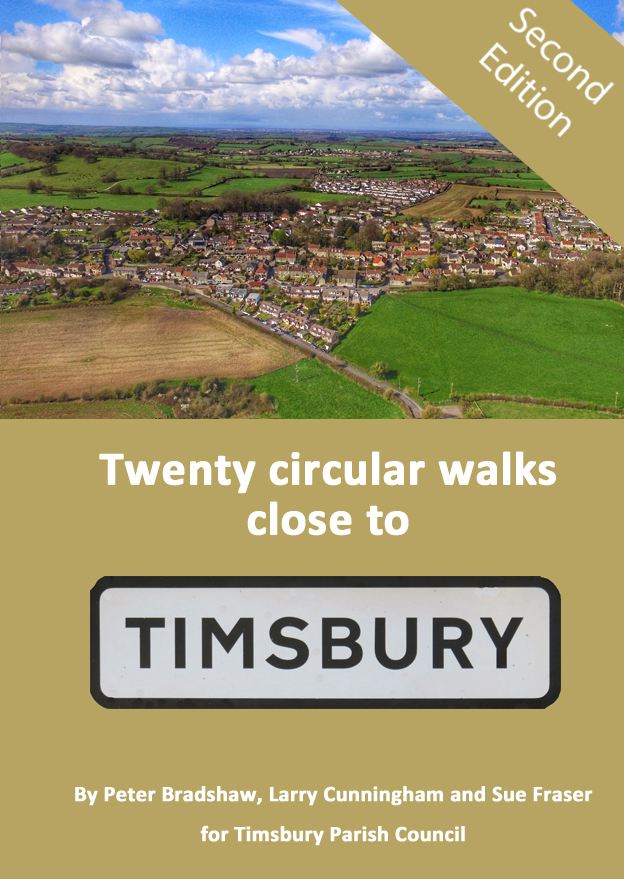
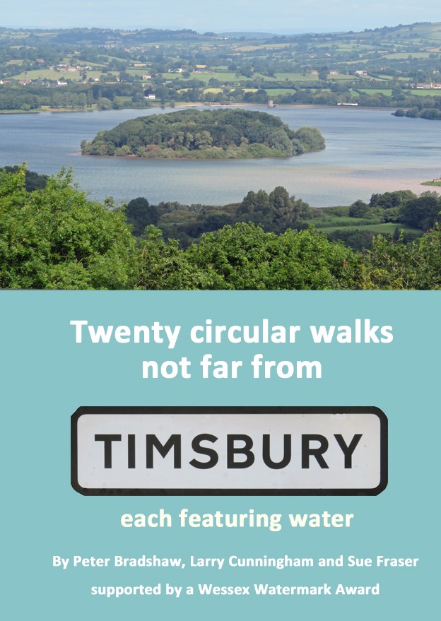
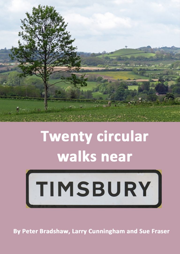
There are five wonderful walking route books written by three local enthusiasts which include walks in and around Timsbury, as well the area immediately beyond the village. All are full colour books with clear and easy to follow route descriptions, maps, photos and interesting background information. The second edition of Twenty circular walks in and Radstock included six extra walks. This meant that one hundred walks had been created over the series of books. Select each image for more details.

The first walking book in the series was published in 2017, updated in the 2nd edition in 2018, the 3rd edition in 2021 and the fourth edition in 2022. It has 66 pages in full colour. Hopefully it will encourage more people to walk and explore Timsbury and its surroundings. Over 3000 copies have been sold so far. All 20 walks start and finish in the centre of Timsbury and range from 0.8 to 7.7 miles. The book is priced £6 and all proceeds go to Timsbury Parish Council.
This book is written by the same authors and is in the same format as the others in the series. The book was commissioned by Radstock Museum and published in 2018. The second edition, with six extra walks, was published in 2023. The walks explore the varied landscapes around Radstock as well as its industrial past. The book is priced at £6.00. It is available from Radstock Museum as well available at the outlets listed on the Walks page.
This book, published in 2019, mirrors the format of the first, Twenty circular walks in and around Timsbury. The updated second edition was available in 2023. Feedback suggests that this suits a wide range of people, with some longer walks for serious ramblers and shorter alternatives for those to just stretch their legs. The walks explore the wider area around Timsbury. The walks are circular and range from 2 to 9 miles long. The book is priced £6 and all proceeds go to Timsbury Parish Council.
The fourth book in the series was published in 2020, updated in the 2nd edition in 2023. It has 94 pages in full colour. It takes walkers close to rivers, canals, lakes, reservoirs and other features associated with water in a wider area and includes walks in Bath, Upper Swainswick and Winsley. The walks range from 1.8 to 8.5 miles. The book is priced £6 and all proceeds go to Water Aid.
This book, published in 2022, mirrors the format of the previous books in the series. Feedback suggests that this suits a wide range of people, with some longer walks for serious ramblers and shorter alternatives for those to just stretch their legs. The walks explore the wider area around Timsbury. The walks are circular and range from 2.4 to 8 miles long. The book is priced £6 and all proceeds go to Avon Wildlife Trust.

Copies of each book can be bought for £6 each from:

Health & More in the High Street, Timsbury

Hub Library in the YMCA by the Coop in North Road, Timsbury

Farmborough Community Shop in Little Lane, Farmborough

Radstock Museum in Waterloo Road, Radstock

Walk in Clare’s Footprints!

Clare Balding came to Timsbury in January 2023 to record an edition of her BBC Radio 4 Ramblings programme. The route chosen was a combination of three sections of walks from the Timsbury Walking Books. It included the historic centre of the village, the Ha-Ha, Amesbury, Paulton Basin, the Somersetshire Coal Canal tow path and then back up to Timsbury. The programme can be listened to at: Villagers’ Walks around Timsbury

The authors, Peter Bradshaw, Larry Cunningham and Sue Fraser were also interviewed by Rob Bayly for his Brunch Show on Somer Valley FM. The show can be heard at: Timsbury Walking Books on Somer Valley FM

A number of requests were received for details of the route. As the route didn’t exactly correspond to one walk from the books, an eight-page A5 colour leaflet was created. It is identical in format to the books, with directions for the route, photographs and historical information. The Parish Council paid for the printing of these leaflets which can be collected free of charge from Health and More, The Hub and The Conygre Hall. As the number available is limited, the leaflet is also available by visiting this page on a PC or laptop to view, print and to download.

View , print or download Walk in Clare’s Footprints

The Coal Canal Way

The Coal Canal Way is a series of linear walks which, when taken together, cover the entire length of the Northern Branch of the disused Somersetshire Coal Canal. (Paulton-Radford-Camerton-Dunkerton-Combe Hay-Midford- Tucking Mill-Monkton Combe-Brassknocker-Dundas). The walks are described in both directions for people who want a short exploration which returns to its starting point. The individual short walks can be linked to those on adjacent pages to form a longer walk for those who prefer greater distances. Each page includes a map at an appropriate scale for that section and a description of the interesting things to be seen on the walk, with a summary of their history.

Buy the Coal Canal Way booklet

Virtual Walks

Chris Selwyn is a keen local walker who has an interest in recording the footpaths in Timsbury. He has created a number of virtual walks:

  • Timsbury Footpaths camera album which a series of virtual walks that are made from photographs that taken in the spring of 2019.
  • A Panoramic Virtual Tour of Historic Timsbury which is a virtual walk-through with photographs of Timsbury taken in the first half of the 20th century overlain modern panoramic photographs.

The Ha-Ha

The Ha-Ha which is a well-known local path which can be reached from St. Mary’s Close at the west of the village. Until the row of houses of the same name were built in the 1970’s this section was a path which was sunken so that the wealthy residents of the now demolished Timsbury House to the south did not have to see the miners walking on their way to and from local mines. Some would call the path a ‘holloway’ as it has a bank on either side. Today it is a lovely walk to the amazing Mendip View at its end.

  • An aerial view from the 1940s showing the Ha-Ha footpath passing Timsbury House. This section of the path has been built over with houses.
  • A view along Ha Ha towards The Avenue in 1950s
    A view along the Ha Ha towards The Avenue in the 1950s
  • Another view from the 1950s showing the sunken section of Ha-Ha close to the bridge on which was the drive to Timsbury House.
    Another view form the 1950s showing the sunken section of Ha-Ha close to the bridge on which the drive to Timsbury House was found.
  • The Ha-Ha is a well known local path. The path used to pass Timsbury House; an Elizabethan building that was the home of the Samborne family for many generations. The house was demolished in 1961. The path was re-surfaced in 2019.
  • There are a number of information boards in the parish. This one is at the end of the Ha-Ha.
  • From the Ha-Ha, there are good views towards other local villages.

Farmborough Common (also known as One Tree or Two Tree Hill)

View of Farmborough Common

These lovely views on the north side of the village are of a hill called Two Tree or One Tree Hill by some people locally. Formally it is part of Farmborough Common, and it is in Farmborough Parish, not Timsbury. Some people want to walk up it, but in fact there is no public right of way up it, just around the east and south as shown on this Ordnance Survey Explore Map. There is no informal right to roam or access either.


RETURN TO HISTORY MAIN MENU

© 2026 Timsbury Parish Council, other than where separately stated · Site created by Picablue
Whilst every effort has been made to maintain accuracy, no responsibility is accepted for any errors in content - see Terms & Conditions
To report problems with the website, contact the webmaster